
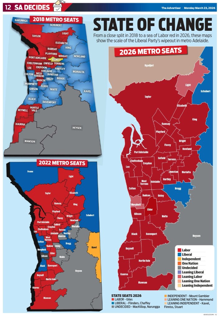
Maps are interesting for a variety of reasons. Today, in Adelaide they show – with overwhelming clarity – the recent State Government election results contrasted over time to highlight the change.
Here’s a short list of the most important maps in world history—important in the sense that they changed how people understood geography, trade, power, or science. The exact ranking is subjective, but these are among the most frequently cited landmark maps in cartography history.[1][2][3]
Landmark maps
- Babylonian Map of the World: often treated as the earliest known world map, showing how ancient Mesopotamians pictured the world.[4][5]
- Ptolemy’s Geographia: foundational for scientific cartography in the classical world and later European mapmaking.[3][1]
- Al-Idrisi’s Tabula Rogeriana (1154): one of the most accurate world maps of its era and a major synthesis of Islamic and classical geographic knowledge.[6][1]
- Tabula Peutingeriana: a remarkable Roman road map that captured an empire as a network of routes rather than as a natural landscape.[3][4]
- Hereford Mappa Mundi: the best-known medieval world map, important for showing medieval European religious and symbolic geography.[4][3]
- Waldseemüller World Map (1507): famous for naming “America” and recognizing the New World as separate from Asia.[7][1]
- Piri Reis World Map (1513): notable for early depictions of Columbus-era discoveries and for being a landmark map of the Age of Discovery.[2][6]
- Mercator Projection (1569): hugely influential for navigation and for shaping how the world was visually represented for centuries.[8][3]
- Cassini Map of France: a breakthrough in state surveying and triangulation, often seen as a birth point of modern national mapping.[1]
- William Smith’s geological map of England and Wales: the first national-scale geological map, a turning point in geology and resource science.[9]
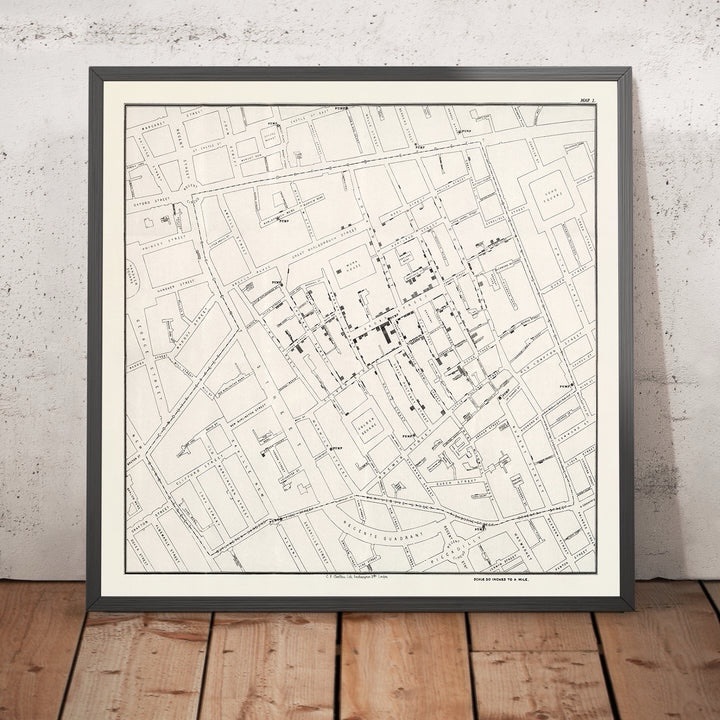
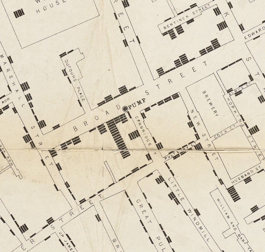
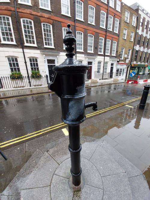
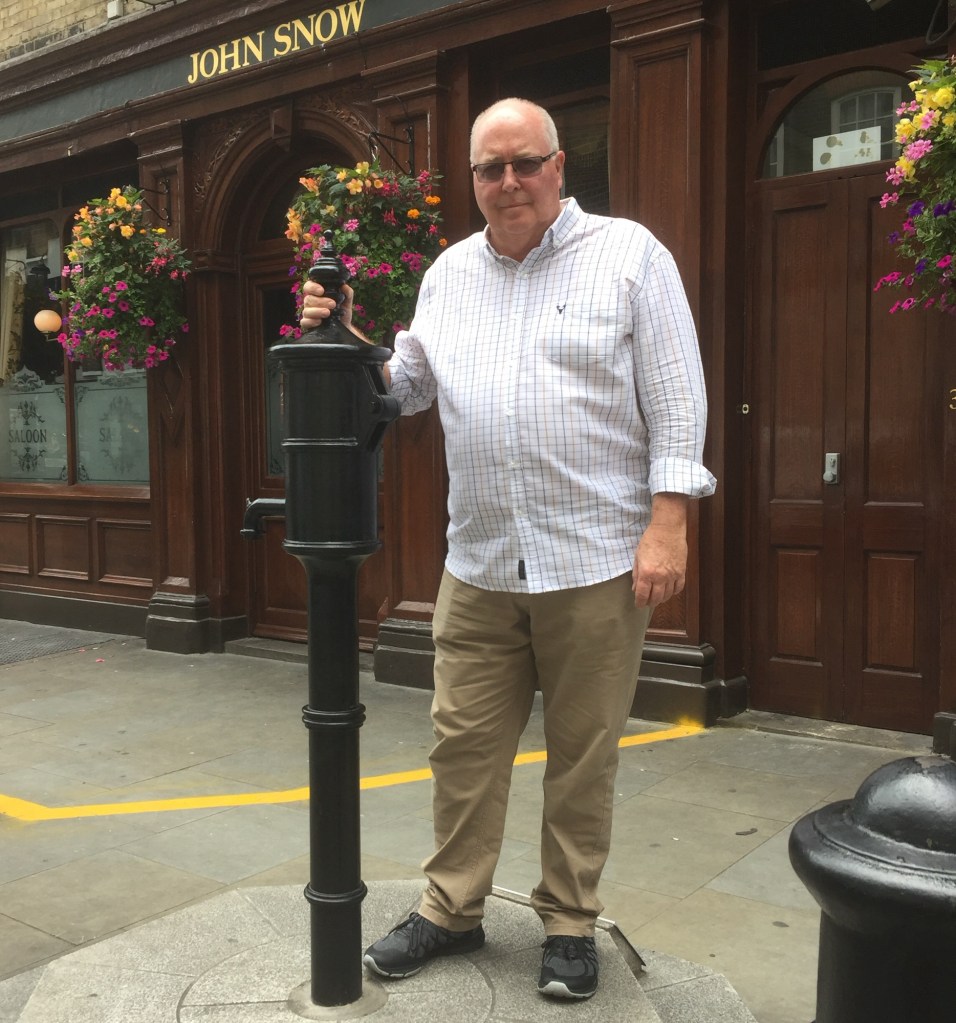
- Broad Street cholera map: a classic example of using mapping to solve a public-health mystery and help launch modern epidemiology.[3]
- Google Maps / Google Earth: the modern equivalent of a world-changing map system, transforming everyday navigation and spatial information access.[3]
Why these matter
These maps mattered because they did more than show places: they changed what people thought the world was, who controlled it, and how knowledge was organized. Some reshaped exploration and empire, others changed science, and some transformed public health and navigation.[2][9][1][3]
My personal favorite – John Snow’s cholera map – is important because it showed that disease could be tracked spatially and linked to a specific environmental source, in this case contaminated water from the Broad Street pump. That was a major break from the then-dominant “bad air” theory and helped establish the idea that careful field data, mapping, and comparison can reveal how outbreaks spread.[ac +3]
Why it mattered
Snow’s map turned a public-health mystery into an evidence-based investigation by plotting deaths and noticing they clustered around the pump. He also compared households served by different water companies and found sharply different cholera death rates, which strengthened the case for waterborne transmission.[bbc +3]
Impact on public health
The map became an early model for epidemiology, especially the use of place, pattern, and rates to identify disease sources. It helped shift public health toward sanitation, safer water systems, and environmental intervention rather than only treating individuals after they became sick.[nih +3]
Sources
[1] 12 Maps That Changed the World – The Atlantic https://www.theatlantic.com/international/archive/2013/12/12-maps-that-changed-the-world/282666/
[2] Examine Important Maps in History – Google Arts & Culture https://artsandculture.google.com/story/examine-important-maps-in-history-unesco-memory-of-the-world/BwUBQg5_6TwbfA?hl=en
[3] 20 Maps That Changed the World – Mental Floss https://www.mentalfloss.com/geography/maps/maps-that-changed-the-world
[4] List of historical maps – Wikipedia https://en.wikipedia.org/wiki/List_of_historical_maps
[5] Maps That Changed Our World – ArcGIS StoryMaps https://storymaps.arcgis.com/stories/9f4996e365784610a565be7e21738da9
[6] Early world maps https://en.wikipedia.org/wiki/Early_world_maps
[7] 9 Famous Maps That Changed the World [and Their Cartographers] https://www.proxi.co/blog/famous-maps-that-changed-the-world
[8] Maps that Changed the World – Geographica https://geographica.net.au/product/maps-that-changed-the-world/
[9] The Map that Changed the World https://en.wikipedia.org/wiki/The_Map_that_Changed_the_World
[10] Maps that shaped the world – BBC News https://www.bbc.com/news/magazine-30840318
[11] The 10 Most Important Maps in the World | Planetizen News https://www.planetizen.com/node/44449
[12] World History Maps & Timelines | GeaCron World History Atlas … http://geacron.com/home-en/
[13] Historical Regions of the World | TimeMap https://oldmapsonline.org/en/history/regions
[14] Historical World Maps – World History Atlas https://www.worldhistorymaps.info
[15] David Rumsey Map Collection https://www.davidrumsey.com
